Mapping Precision for Tomorrow
Transforming Bangladesh’s terrain with precise, high-quality GIS surveying and consultancy. Trust Geospatial Works.
Organizations We’ve Worked With

Our Core Services
Delivering precision and expertise across every dimension of geospatial surveying.
Accurate Topography Surveys
Transform your project with our accurate topography surveys, expertly conducted to ensure precise results.
Comprehensive Geotechnical and Hydro-geological Services
Transform your project with our comprehensive geotechnical and hydro-geological services.
Precise Bathymetry Surveys
Tailored bathymetry surveys that provide accurate and detailed underwater data.
Digital Surveying
Modern surveying techniques using advanced instruments and UAV technology.
Geospatial Consultancy
Strategic geospatial planning and GIS-based decision support services.
Remote Sensing
Advanced satellite and remote sensing data analysis for environmental and resource monitoring.
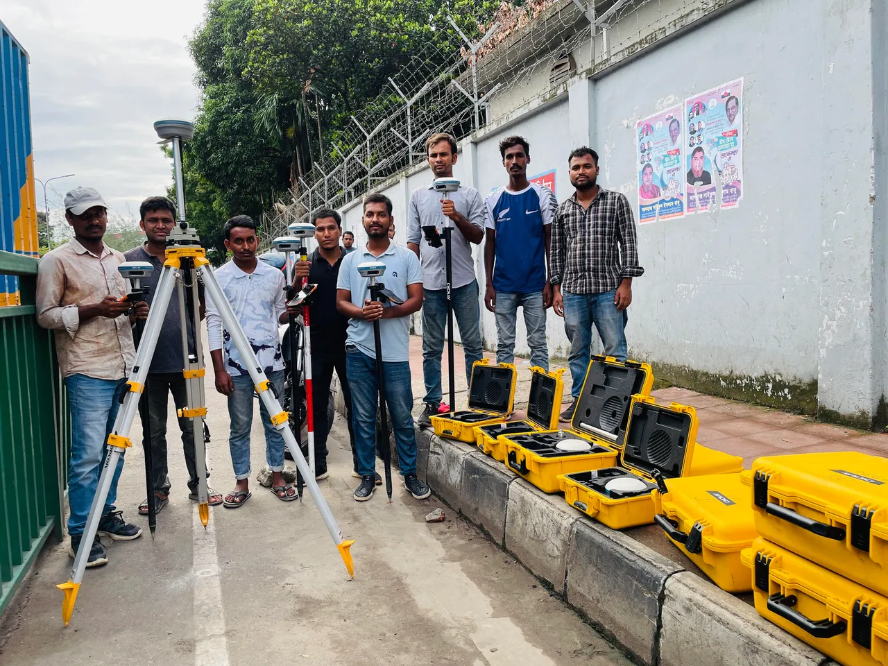
Our Skilled GIS Surveyors Deliver Precise Geospatial Solutions
Transforming terrains with precise surveys and innovative technologies. Enhancing project outcomes. Let us turn your vision into reality.
Years of Excellence
With over 5 years of experience, we have mastered our skills in GIS surveying and consultancy services.
Satisfied Clients, Accurate Surveys
We have successfully served over 1000 clients who have relied on our precise and reliable survey solutions.
Delivering Comprehensive Survey Solutions
Our comprehensive survey solutions have been recognized by leading industry professionals and have garnered numerous commendations.
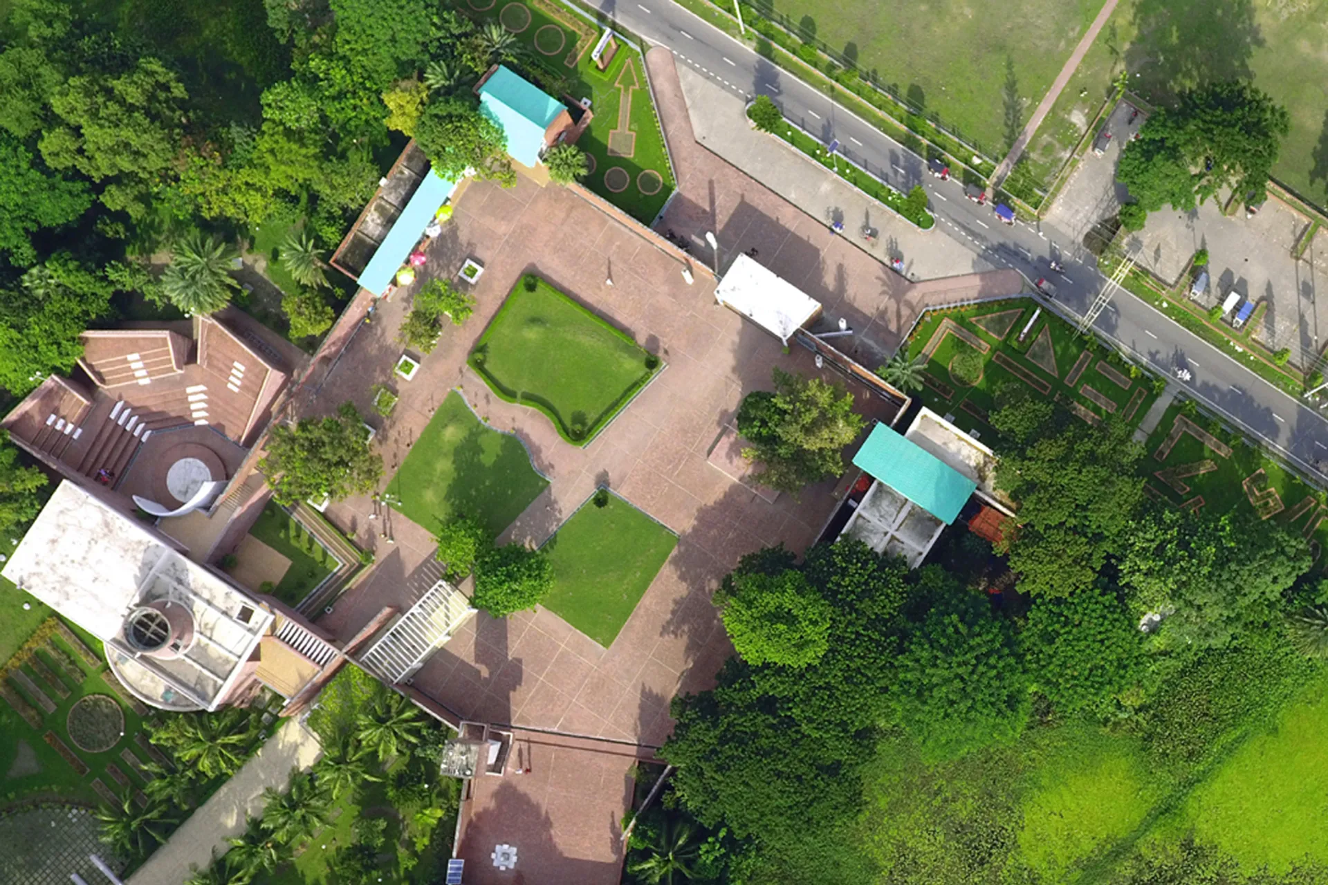
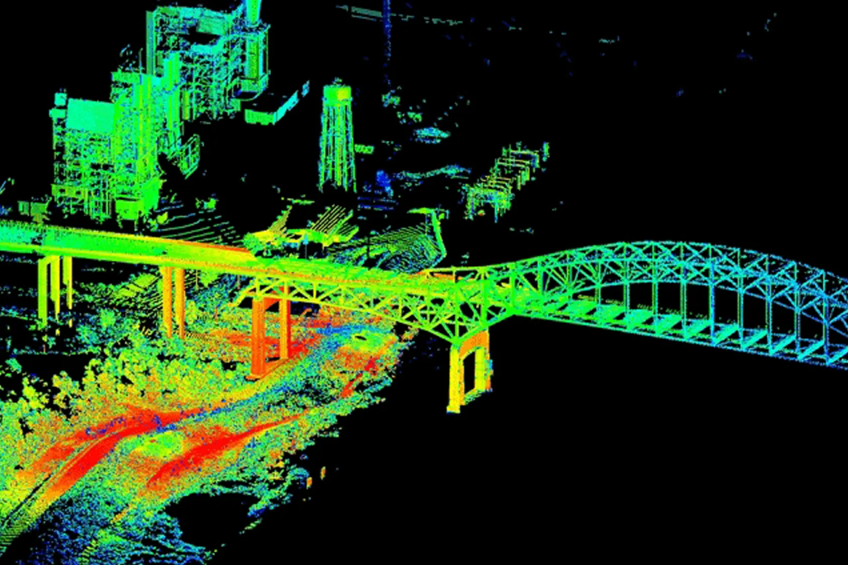
Accurate aerial image corrected for true ground position.
Orthophotos are aerial images corrected to remove distortion caused by terrain relief and camera angle. They offer accurate representations of the Earth's surface, suitable for mapping and analysis.
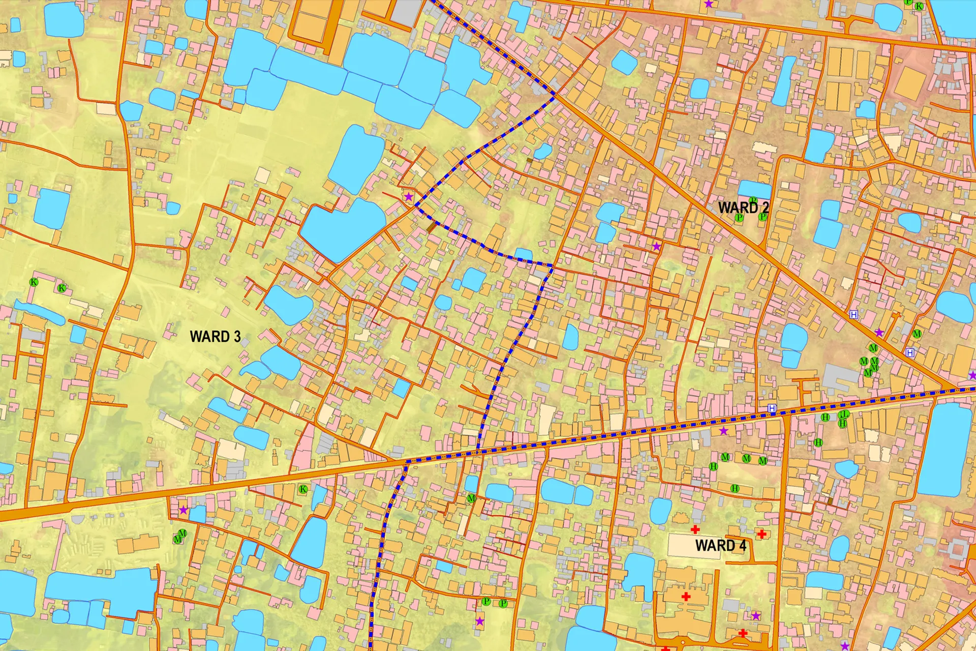
Our Specialized Capabilities

Comprehensive Bathymetry Studies

Hydro-Geological Studies

Advanced RTK Drone Mapping

Transforming Sites with Innovative GIS Solutions
Our Vision
Since its establishment, Geospatial Works aim is to be known as a multidisciplinary consulting firm with the ability to complete projects successfully in various fields of consulting services in which we specialize. The central functions are managed through a number of units, including Physical Planning, Human Resource Development, Research & Development, Quality & System Management, GIS in Geospatial & Geotechnical arena, Information Technology (IT), Quantitative and qualitative surveying.